Northern California Swamped With “Historic Rain” Amid Rare Atmospheric River Event
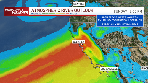
The National Weather Service’s (NWS) Sacramento office said “potentially historic rain” rain has fallen in parts of Northern California after a bomb cyclone accompanied an atmospheric river that unleashed massive amounts of moisture pulled in from the Pacific Ocean.
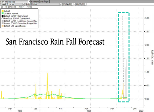
Northern California bore the brunt late Saturday/Sunday, with record rainfall in some areas. NWS Bay Area said, “We just passed the Gold Rush year of 1849 for 7th wettest October on record for Downtown SF. 1876 (3.36) here we come..(Current value is 3.14 which ties 1849).”
SR-70 remains closed due to multiple #Rockslides, #Landsslides and #floodings
📸 CHP – HQ#AtmosphericRiver #California #Rain #Storm #PlumasCounty pic.twitter.com/8KtOiyjGO7
— Michael Barthel (@RealMiBaWi) October 24, 2021
“If you are in the vicinity of a recent burn scar and haven’t already, prepare now for likely debris flows,” the Sacramento weather service tweeted. “If you are told to evacuate by local officials, or you feel threatened, do not hesitate to do so. If it is too late to evacuate, get to higher ground.”
Flooded streets were reported across the Bay Area, closing some in Berkeley and Oakland’s Bay Bridge toll plaza. Just north of San Francisco, a whopping 6 inches of rain has fallen this weekend. Rainfall estimates for the Bay Area show at least 3 inches have fallen, trouncing any other storm in years.
“Some of our higher elevation locations could see 6, 7, 8 inches of rain before we’re all said and done,” Sean Miller, a meteorologist for the NWS in Monterey.
The convergence of storms brings Northern California a huge relief amid devastating droughts and wildfires this past summer.
…click on the above link to read the rest of the article…

