Winter Blast To Dump Heavy Snow Across Rockies, Plains, Midwest This Week
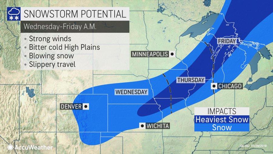
Several major snowstorms are expected to dump heavy snow across the Rockies, the Plains, and into the Midwest this week as cold Arctic air blankets those regions in the last days of October.

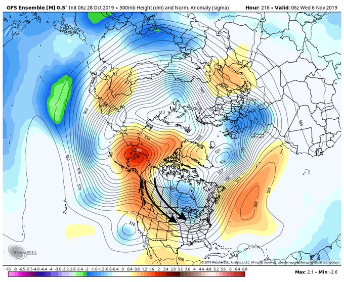
The potential for cold into November? It’s complicated.
In today’s midday updates, we break down the importance of high latitude blocking and what we can expect in a critical month ahead. http://empireweather.com #natgas #energy #agwx

The Weather Channel is reporting “a southward plunge of the jet stream from the Rockies into the central US has entrenched a pipeline of arctic air over those regions. Two weather systems tapping into that cold air are producing snowfall as they track from the Rockies to the Plains and into Midwest.”

The National Weather Service (NWS) has issued winter weather alerts across the northern and central Rockies and central High Plains.
Denver-Boulder corridor, located in northern Colorado, has been placed under a winter storm warning through Wednesday morning. The region could see 6 to 12 inches of snow on through Tuesday night.
From Tuesday evening into Wednesday, snow will be seen in the Central Plains, Midwest, and the Rockies.
The Weather Channel said an area of low pressure will form near the Great Lakes on Thursday, could produce the first accumulating snow for northeastern Missouri into eastern Iowa, western and northern Illinois, and southern Wisconsin.
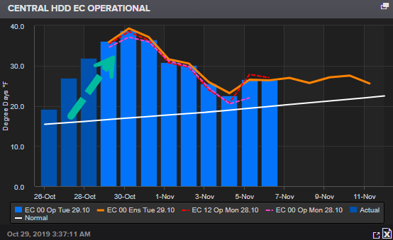
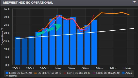
With a plunge in the jetstream, Central and Midwest heating degree day (HDD) indexes, a measurement designed to quantify the demand for heating a building, have moved above trend through the end of the month into the first week of November.


A similar pattern in HDD is also seen in the lower-48, suggests that energy demand is increasing as the winter season begins.
…click on the above link to read the rest of the article…