Home » Posts tagged 'flooding' (Page 6)

Tag Archives: flooding

Olduvai
Click on image to purchase

Olduvai III: Catacylsm
Click on image to purchase

Post categories

Post Archives by Category

The Great Flood

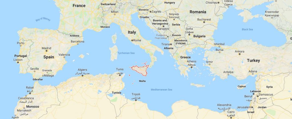
There is little doubt that the amount of water on earth really does not change. There is simply what is known as the Water Cycle whereby evaporation moves water to the sky and then it is redistributed as rain elsewhere. Therefore, the likelihood of an actual flood in Biblical terms that covered the entire world is unlikely. What we do know is that there is a wealth of evidence that the movement of the plates clearly resulted in the great flood that created the Mediterranean sea and there is also evidence that there are cities under the Black Sea no less the Mediterranean.

There is evidence that there was a tremendous flood when there was a break in the land at the Straits of Gibralter. What has surfaced is evidence that when that breach took place, the water rushed into the basin at probably around 100 mph. This is certainly something that would be remembered and probably handed down from generation to generation. (see Scientific American)

Nevertheless, it is also obvious that the sea level has risen in the Mediterranean even since the time of Julius Caesar (100-44BC).  The city of ancient Alexandria in Egypt lies below the sea. Obviously, even in relatively modern times, the sea level has risen flooding communities. So actually stating definitively when did the Biblical Event of the flood take place is difficult to pinpoint because there have been great floods from 3 million years ago to 2,000 years ago.  What is certain is that the sea levels have risen and fallen and this is part of nature – not instigated by humans.

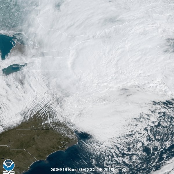
7 Dead After “Monster Nor’easter” Pummels East Coast, Leaving Floods, Outages

At least seven people were dead after a “monster nor’easter” – officially called Winter Storm Riley – slammed the northeastern United States on Saturday, leaving a trail of flooded streets, power outages and brutal winds.


Spotted by @NOAASatellites satellite: today’s is seen spinning off the Atlantic Northeast. This storm is slamming the East Coast with intense winds, snow, rain and hail. More: https://www.star.nesdis.noaa.gov/GOES/GOES16_sector_band.php?sector=ne&band=GEOCOLOR&length=24 


A 6-year-old boy died in Virginia after a tree fell on his family’s home, officials said. Others include an 11-year-old boy hit by a falling tree in New York state, a 57-year-old man in Upper Merion, Pennsylvania, hit by a tree while in his car and a 77-year-old woman struck by a branch outside her home in Baltimore.

The Tewksbury Police posted this photo to their Twitter account of a tree severely damaging a jeep, March 2

The storm strengthened rapidly Friday, undergoing what’s known as bombogenesis or “bombing out,” when a low-pressure system drops 24 millibars in 24 hours. It was the second “bomb cyclone,” to hit the region after a similar storm hit the northeast back in early January. home in Baltimore.

Rubble rests on top of a car after a partially burnt building collapsed due to strong winds in Northeast Washington

According to Reuters, almost 2.4 million homes and businesses had no power in the Northeast and Midwest early on Saturday. Some utility companies warned customers that power might not be restored until later in the day or Sunday.

Wind knocks down power poles onto Arsenal Street in Watertown, Mass., March 2

New York City saw a mix of rain, snow, sleet and winds that wrapped up by evening. Over 4 inches of rain fell in eastern Long Island and parts of eastern Massachusetts.

…click on the above link to read the rest of the article…

State of emergency, child missing amid Ontario floods

State of emergency, child missing amid Ontario floods

Brantford state of emergency: HIGHLIGHTS, must-see visuals of ice jam

Thursday, February 22, 2018, 7:34 AM – Wednesday was marked by flood crises in parts of southern Ontario, particularly the Grand River, where flood warnings were still in effect for much of its watershed Thursday. One person remains missing.

Ice jams and days of rain made for elevated water levels, forcing road closures in several communities throughout the day Wednesday, including Cambridge and Brantford.

The latter city was forced to declare a state of emergency, and issued an evacuation order affecting almost 5,000 people in the Holmedale, Old West Brant, and Eagle Place areas of the community, which remained in effect into Thursday morning.

Watch below: Ice chunks cover entire Ontario highway, see it here


Some ice jams did clear Wednesday, relieving flooding pressure somewhat, but leaving behind massive chunks of ice for crews to clear. At one point, a sink hole on Highway 401 westbound at Highway 24 in Cambridge forced a highway closure that lasted into the evening before all lanes reopened.

The Canadian Coast Guard spent Tuesday breaking up ice at the mouth of the Grand River on Lake Erie, and spokeswoman Carol Launderville said the CCGS Griffon returned for another round Wednesday.

“The commanding officer of the CCGS Griffon, Michael Hines, reported fast ice from one side of the Grand River to the other and nothing had started to break until the icebreaker arrived,” Launderville says. “By the end of Tuesday afternoon, open water started to form at the upper end of our track as the broken ice flowed towards the mouth of the river. The Coast Guard broke the ice to the approaches and out onto the lake. After the ice starts to move away from the mouth, the ice in the river will have a place to go.”

…click on the above link to read the rest of the article…

After Wildfires, Californians Warned: ‘You Will See Rapid Flooding, People TRAPPED’

After Wildfires, Californians Warned: ‘You Will See Rapid Flooding, People TRAPPED’

Experts are warning that California’s state capital could be the next hot spot to experience massive flooding on catastrophe levels. Officials are admitting that one particular Sacramento neighborhood is in an area that never should have been settled, to begin with.

The neighborhood slopes downward from a levee that separates it from the American River, and even though officials said it should not have ever been settled, it is home to 100,000 residents. “I am just trying to imagine what three feet of water in my house would look like, and based on that, I moved things higher,” said Marion Townsend a 53-year-old resident. “And if the evacuation order comes, I want to know what I should grab.”

But models of the levee’s failure show not only a meager 3 feet of water inside homes. Some are predicting as much as 20 feet of water to flood Sacramento homes. As Northern Californians are recovering from wildfires and sifting through homes reduced to ash, officials in the state’s capital are struggling to prevent another type of natural disaster. If a levee were to break along the American River, which empties into the Sacramento River near downtown, water would start flowing into the city. Although floodgates could be quickly deployed to protect downtown Sacramento from a life-threatening deluge, the water would eventually seep in from other directions, covering much of the area in several feet of water, said Roger Ince, a Sacramento emergency coordinator.

“You are not going to see a wall of water coming into Sacramento, but you will see rapid flooding and people not able to get out of their homes, out of care facilities. They are trapped,” said Stephen Cantelme, chief of Sacramento County’s Emergency Services. “I am much more confident in our levees holding up than I was 10 years ago. . . . But I am concerned 200-year [flood protection] is not enough.”

…click on the above link to read the rest of the article…
Preparing for Floods, Droughts and Water Shortages by Working with, Rather than Against, Nature

Preparing for Floods, Droughts and Water Shortages by Working with, Rather than Against, Nature 

[This piece is an excerpt from the first chapter of my new book, Replenish: The Virtuous Cycle of Water and Prosperity, released this week by Island Press.]

As I wound my way up Poudre Canyon in northern Colorado, the river flowed toward the plains below, glistening in the midday sun. It ran easy and low, as it normally does as the autumn approaches, with the snowmelt long gone. I was struck by the canyon’s beauty, but also by the blackened soils and charred tree trunks that marred the steep mountains all around. They were legacies, I realized, of the High Park Fire that had burned more than 135 square miles (350 square kilometers) of forest during the previous year’s drought.

It was September 7, 2013, and my family and I were heading to my niece’s wedding. Tara and Eric had chosen a spectacular place for their nuptials—Sky Ranch, a high mountain camp not far from the eastern fringe of Rocky Mountain National Park. As we escorted my elderly parents down the rocky path to their seats, I noticed threatening clouds moving in. They darkened as the preacher delivered his homily. Please cut it short and marry them, I thought to myself, before we all get drenched.

The rains held off just long enough. But that day’s brief shower was a prelude to a deluge of biblical proportions that began four days later. A storm system stalled over the Front Range and in less than a week dumped nearly a year’s worth of precipitation in some areas. The Poudre— short for Cache la Poudre—flooded bigger than it had since 1930.

…click on the above link to read the rest of the article…

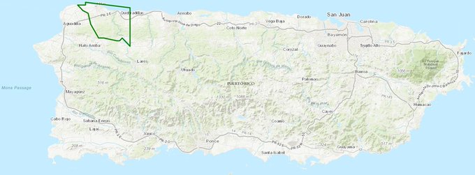
NWS Declares “Extremely Dangerous Situation” After Puerto Rico Dam Fails

With electricity and cell phone service still offline across most of hurricane-damaged island, NBC reports that a dam in northwest Puerto Rico has failed, causing even more flash flooding and prompting emergency evacuations.

Guajataca Dam operators said it failed at 2:10 pm ET, prompting the NWS to issue a flash flood emergency warning for Isabela and Quebradillas municipalities.

“This is an EXTREMELY DANGEROUS SITUATION. Busses are currently evacuating people from the area as quickly as they can,” NWS San Juan said.

The Terrifying Risk of Climate Change in Scotland

The Terrifying Risk of Climate Change in Scotland

“Major parts of Scotland’s vital infrastructure are under threat from coastal erosion and flooding, according to the latest government assessments of the dangers of climate change.

Thousands of homes and businesses and long stretches of roads and railway lines are also at risk. So are power stations, wind farms, sewers, bridges, and farmland, as well as many other crucial facilities and even golf courses.

Seabirds, fish and plants are endangered, as well as butterflies, food crops and peat bogs. Scotland can expect more rain, more droughts, more storms, more wild fires, more landslides, more pests and more diseases – and snow is disappearing from the mountains.”

I don’t know if its my imagination, but the media seem to have gone into overdrive reporting the terrifying risks of climate change alongside too-cheap-to-meter solar and wind power that is to be our salvation. Last week, the Sunday Herald carried one of the worst pieces of climate change doomer porn I’ve ever seen: Revealed: climate change and the terrifying risk to Scotland. One problem I have with this post is that The Herald article does not link to the reports cited. Reference is made to Scottish National Heritage (a government agency) and The UK Committee on Climate Change. Friends of The Earth and World Wildlife Fund are also mentioned. Roger Andrews helped me out and compiled the references listed at the end of this post upon which I assume Rob Edwards reporting for the Sunday Herald used in compiling his article.

In my last post on UK flooding I felt inclined to forgive the BBC for simply reporting the dross published by accademics in Science. However, I will not forgive Rob Edwards and the editorial staff at The Herald for uncritically hyping the contents of what appear to be wildly inaccurate government and NGO reports.

…click on the above link to read the rest of the article…
CO2 is Changing the Jet Stream in Ways that will Create more Harveys

“The record for total rainfall from a tropical system has been BROKEN!” the National Weather Service tweeted Tuesday morning. The previous record for wettest tropical system in the continental United States was 48 inches. Harvey had already hit 49.20, and the rain was still coming.

“Many textbooks have the 60-inch mark as a once-in-a-million-year recurrence interval,” as the Washington Post Weather Gang reported Sunday.

We’re seeing these staggering rainfall totals because this tropical storm hovered in place for days over southeast Texas, sweeping in vast quantities of moisture from the warm waters in the Gulf of Mexico. And the latest science points a finger at climate change for this.

“The kind of stalled weather pattern that is drenching Houston is precisely the sort of pattern we expect because of climate change,” climatologist Michael Mann explained in an email to ThinkProgress. Earlier this year, Mann co-authored a study explaining how human-caused warming is changing our atmosphere’s circulation, including the jet stream, in a way that leads to “increase in persistent weather extremes” during the summer.

“I agree with Mike [Mann] that the weak steering currents over the south-central US coincident with Harvey are consistent with our expectations for a warmer world, which of course includes effects of a very warm Arctic,” Jennifer Francis, a climate scientist at Rutgers University, told ThinkProgress.

…click on the above link to read the rest of the article…

Harvey Makes Second Landfall In Louisiana After Leaving “Apocalyptic” Flooding, Record Rainfall In Texas

Harvey Makes Second Landfall In Louisiana After Leaving “Apocalyptic” Flooding, Record Rainfall In Texas

Five days after it first plowed into southwest Texas as a category 4 hurricane, Tropical Storm Harvey has made second landfall west of Cameron on the border between Texas and Louisiana, early Wednesday according to the National Hurricane Center. The storm, which has already pummeled the city of Houston with more than 50 inches of rain – a new record for the contiguous US, according to the Wall Street Journal – has left at least 18 dead, including two Houston police officers, and forced tens of thousands of people from their homes.

Though the hurricane (now tropical storm) has wreaked widespread devastation on Texas, Reuters says citizens of Western Louisiana have at least one silver lining to cling to: torrential rains are expected to cease later on Wednesday as the storm picks up speed and moves northeast away from the Gulf of Mexico. NOAA was forecasting less than an inch of rain for the Houston area on Wednesday, with a slight chance of sunshine.

“Harvey, which made landfall west of Cameron, Louisiana on Wednesday, was expected to produce an additional 3 to 6 inches (7.5 to 15.24 cms) of rain to an area about 80 miles east of Houston as well as southwestern Louisiana, where some areas have already seen more than 17 inches of rain.

It is projected to weaken as it moves inland to the northeast, the National Hurricane Center said.

“We aren’t going to be dealing with it for too much longer. It’s going to pick up the pace and get out of here,” said Donald Jones, a meteorologist at the National Weather Service in Lake Charles, Louisiana.”

UK Flooding Events and Fake Science

UK Flooding Events and Fake Science

Blöschl et al (2017, ref 1) published a paper in Sciencethat purports to show flooding in S England occurs every year but only ever in January and that flooding is disconnected in time from extreme rainfall events via water storage in soils. The changing pattern with time is ascribed to man-made climate change and implications for insurance were highlighted by the Financial Times.

A simple analysis of actual UK flood records from the UK Met Office shows that floods actually occurred throughout the year and that these are always directly associated with extreme heavy rainfall of either convective or cyclonic origin. According to Blöschl et al, floods in Southern England occur only in January (Fig 1), but the Met Office records show no flooding in Southern England in January at all.

On Monday last week I had a post titled European Floods and Fake Science and in it I said I would return to the subject with a more detailed look at the pattern of UK floods in recent decades as reported by the UK Met Office and to compare this real world with the imaginary world of climate science. There is no semblance of similarity between the two when it comes to UK floods and I dare say this may apply across the board.

The two data sets I use here are the S England flood data published by Blöschl et al in the once-esteemed journal Science [ref 1] and a qualitative diary of extreme UK weather events in the UK published on-line by the UK Met Office [ref 2]. The latter includes journalistic entries on uncommon hot, cold, dry, wet and windy conditions. I have extracted the entries on uncommon wet events that led to flooding and reproduced these in Appendix 1 and Figure 2.

…click on the above link to read the rest of the article…

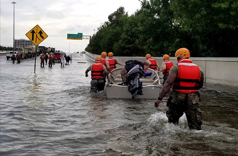
Harvey is already the worst rainstorm in U.S. history, and it’s still raining

Reuters / Richard Carson

Harvey is already the worst rainstorm in U.S. history, and it’s still raining

The pictures are heartbreaking, the statistics are mind-boggling. And, incredibly, it’s still getting worse.

Since Hurricane Harvey made landfall in Texas late Friday night, more than 40 inches of rain have fallen in parts of the Houston metro area, producing the worst flood in the city’s modern history. The latest forecasts show another 15-25 inches on the way before Harvey clears out of the area on Wednesday. Harvey is sure to rank as the worst rainstorm in U.S. history, according to an initial analysis from the Texas state climatologist.

“Of course I’m surprised,” Houston meteorologist Tim Heller told Grist. “We tell people to prepare for the worst, but this is worse than the worst! This isn’t isolated flooding, this isn’t neighborhood flooding, this is area flooding, regional flooding. The warnings were there for 15-25 [inches] of rain, then 30, then 40. I quit giving out storm totals because I’m not sure what we’ll end up with now.”

The amount of rain so far brings new meaning to the word “unprecedented.” In just three days, Houston doubled the previous record rainfall for a full month — 19.21 inches set in June 2001 during Tropical Storm Allison (which caused the city’s previously worst flood).

So much rain has fallen that the National Weather Service had to add additional colors to its maps, in order to show rainfall totals this huge. During the peak of the rainfall on Saturday night, the local NWS office in Houston ad-libbed a dire warning and issued a “Flash Flood Emergency for Life-Threatening Catastrophic Flooding” — the first time the already-dire “Flash Flood Emergency” was considered insufficient to describe the impending risk.

…click on the above link to read the rest of the article…

There Is “Eight Feet Of Water” On Houston Roads, And It’s About To Get Much Worse

There Is “Eight Feet Of Water” On Houston Roads, And It’s About To Get Much Worse

Amid desperate efforts to save stranded citizens – police report over 3,000 rescues alone – and the arrival of the so-called ‘cajun navy’to assist, Harvey continues to pummel Texas, paralyzing Houston as the region braces for yet more rain after the Tropical Storm recharged over warm waters and heading back in-land.

“This is, if not the largest, it has to be categorized as one of the largest disasters America has ever faced,” Texas Gov. Greg Abbott declared at a press conference Monday afternoon.

Houston’s main water-way, Buffalo Bayou, shows over 30 inches of rain and it’s about to get a lot worse. Buffalo Bayou is the main waterway that snakes through the heart of Houston, and the water levels of two reservoirs that feed into it are particularly concerning.

“The reality is the water is continuing to rise,” Mr. Turner said. “The water level along Buffalo Bayou in all likelihood will increase.”

Forecasters say Harvey will move slowly to the northeast throughout the week and shower some parts of the state with another 15 to 20 inches of rainfall by the end of Thursday. Additionally, The Post reports that certain areas to the west of Houston could see as much as 50 inches of rain by the time the storm is over — which would be the largest recorded total in Texas history.

The death toll remains unclear.

WSJ notes that on Monday evening, Mayor Sylvester Turner said three deaths in Houston had occurred during the storm but could not confirm reports that a family of six had died in their vehicle.

…click on the above link to read the rest of the article…

European Floods and Fake Science

European Floods and Fake Science

I wrote a post a couple of weeks ago targeting the BBC for biased reporting on energy and climate issues. It was never published because in writing it I realised that the the problem did not necessarily lie with the BBC but with the climate science fraternity. Another alarmist article appeared in Blowout last week covered by the BBC with the headline “Climate change has shifted the timing of European floods” accompanied by a picture of an Alpine village being swept away. The article in question (Blöschl et al [1] published in Science) does not contain any actual data on European floods. The ten year average of peak annual river flow is used instead which is a meaningless proxy for actual flooding. The authors fail to make an empirical connection between trends in peak annual flow and trends in actual flooding which is a basic scientific error.

The FT also picked up this story citing implications for hydroelectric power and insurers which may well be used as an excuse to raise premiums, yet again. The scientific article in question was published in Science and I decided to have a closer look.

The BBC headline:

In different parts of Europe, rivers are flooding earlier or later because of rising temperatures, say scientists.

And Blöschl et al say in the abstract:

Warmer temperatures have led to earlier spring snowmelt floods throughout northeastern Europe; delayed winter storms associated with polar warming have led to later winter floods around the North Sea and some sectors of the Mediterranean coast

Polar Warming

Let us begin by taking a look at “polar warming” at the N Pole. We don’t have climate records for the N Pole and so I will use instead 32 high latitude climate stations from either side of the Arctic Circle in Norway, Sweden, Finland and Russia (Figures 1 and 2), as reported in Record Arctic Warmth – in 1937.

…click on the above link to read the rest of the article…

Wet weather walloping much of Ontario, Quebec and heading east

Wet weather walloping much of Ontario, Quebec and heading east

Ottawa River, Laurentian communities hit hard; New Brunswick expected to be next

Some Pointe-Gatineau, Que., residents have had to abandon their cars trapped by flooding. Firefighters have gone door-to-door in parts of Gatineau to warn residents of the dangers of staying put as forecasts call for rain throughout the weekend.

Some Pointe-Gatineau, Que., residents have had to abandon their cars trapped by flooding. Firefighters have gone door-to-door in parts of Gatineau to warn residents of the dangers of staying put as forecasts call for rain throughout the weekend. (CBC)Poster of video clipPoster of video clipHeavy rainfall affected airline passengers in Canada’s busiest airport on Friday, while voluntary evacuation orders were in effect in some areas of Ontario and Quebec.

Environment Canada has issued a special weather statement for much of Quebec and a rainfall warning for much of southern and eastern Ontario. New Brunswick, particularly the southern part of the province, will be in the crosshairs of the slow-moving system beginning Friday night and into Saturday.

Prime Minister Justin Trudeau, in Montreal on Friday morning, said the federal government is closely monitoring the flood threat.

“Our thoughts are with the families, the communities affected by the severe flooding that’s going on throughout Quebec and indeed across the country,” he said.

He praised the volunteers and first responders helping out and said Ottawa was ready to respond to formal requests for assistance.

“We will, of course, be there as the cleanup continues after the waters recede,” he said.

In all affected areas, residents are being warned to stay away from banks of rivers and streams and low-lying areas and to avoid driving into standing water. Homeowners are advised to ensure valuables aren’t kept in basements, to make sure catch basins and eaves are clear of leaves and debris, and to call 311 to report any flooding issues.

Quebec

The most wide-ranging threats of flooding are in Quebec, with 124 communities in the province affected.

Urgences Québec says more than 1,326 residences in the province have been affected by flooding this week, with at least 700 people forced out of their homes.

…click on the above link to read the rest of the article…
Droughts, floods from weird jet stream linked to Arctic heat

Droughts, floods from weird jet stream linked to Arctic heat

Something strange is going on, with more incidences of unprecedented heat waves, droughts and flooding happening in recent years, and based on the latest research, it’s looking more and more like climate change is to blame.

The Arctic is warming faster than anywhere else on the planet, due to global warming and the resulting changes it is causing to Earth’s climate. For 2016 alone, NASA recorded an average temperature anomaly in the Arctic of over three times what was observed at the equator.

According to a new study in the journal Nature Scientific Reports, headed by Penn State climate scientist Michael E. Mann, the jet stream is being locked into some strange, persistent patterns by this Arctic heat, and this, in turn, is fueling some of the extreme, unprecedented weather events we have been experiencing in the last few decades.

“The warming of the Arctic, the polar amplification of warming, plays a key role here,” Mann told Penn State News. “The surface and lower atmosphere are warming more in the Arctic than anywhere else on the globe. That pattern projects onto the very temperature gradient profile that we identify as supporting atmospheric waveguide conditions.”


Map of global temperature anomalies for 2016, compared to the 20th Century average. The Arctic was roughly 3.2oC above average vs 1oC above average at the equator. Credit: NASA GISS

There is a fairly simple premise that drives the activity of the jet stream: the speed of the winds in the stream is strongly influenced by how the temperature changes between the equator and the pole (ie: the temperature gradient).

…click on the above link to read the rest of the article…

Olduvai IV: Courage
Click on image to read excerpts

Olduvai II: Exodus
Click on image to purchase

Click on image to purchase @ FriesenPress