As meteorologists expected, the storm formerly known as Hurricane Florence (it was downgraded to a tropical depression on Sunday after previously being cut to a tropical storm) is stubbornly lingering over the Carolinas and dumping an unceasing assault of warm ocean water on the state.
Radar showed that parts of the storm were impacting six states, but North and South Carolina remained in the bulls eye. The worst hit parts of North and South Carolina have already been inundated with more than two feet of rain, and forecasters are saying there could be an additional 1.5 feet before the end of day Sunday, according to the Associated Press. For this reason, disaster analysts have said the storm is expected to be the costliest in US history, with damages exceeding $170 billion.
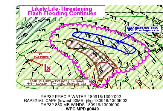
Here is a new mesoscale precipitation discussion from @NWSWPC on ongoing life-threatening flash flooding from #Florence in southern NC and northern SC https://www.wpc.ncep.noaa.gov/metwatch/metwatch_mpd_multi.php?md=0849&yr=2018 …
While wind speeds have slackened to 35 mph from an initial windspeed of more than 90 mph when Florence first came ashore, the storm has continued its crawl west at 8 mph. At 5 am, the storm was centered about 20 miles southwest of Columbia, South Carolina.
Meteorologists forecast “catastrophic” flooding in both North and South Carolina, as some areas will be coated with more than 40 inches of rain, according to USA Today. Meanwhile, the death toll has risen to 15 people, and is expected to rise.
“These rainfall amounts will produce catastrophic flash flooding, prolonged significant river flooding and an elevated risk for landslides in western North Carolina and far southwest Virginia,” the hurricane center warned.
…click on the above link to read the rest of the article…
