Home » Posts tagged 'flooding' (Page 7)

Tag Archives: flooding

Olduvai
Click on image to purchase

Olduvai III: Catacylsm
Click on image to purchase

Post categories

Post Archives by Category

California Floods To Trigger “The Big One”? – Geologists Warn Of Quake Risks From Snowpack, Rising Reservoirs

California Floods To Trigger “The Big One”? – Geologists Warn Of Quake Risks From Snowpack, Rising Reservoirs

For years geologists have warned that Southern California is overdue for “The Big One”, a massive 8.0 or greater earthquake that would undoubtedly cause unprecedented death and destruction in several heavily populated urban centers sprinkled along the San Andreas Fault line.

While predicting earthquakes remains an uncertain science, there has been concern in recent years among experts that the San Andreas fault may be close to a new, major ruction if only by virtue of the length of time since it happened last, when the southern portion of the fault was struck by a 7.9 shaker all the way back in 1857.

Since then the tectonic plates that meet at the fault have been continuously on the move at a rate of about 2 inches per year. That means that over 159 years there has been a shift of 26 feet as the Pacific plate moves in a northwesterly direction against the American continental plate.  Every additional inch creates additional pressures on the rocks beneath the earth’s surface that builds and builds until it eventually snaps.

San Andreas


Now, as the Los Angeles Times points out, the recent flooding in California has prompted some scientists to raise concerns over whether or not Californians are at a greater risk of being struck by an imminent quake.  According to geologists, flooding can cause earthquakes in one of two ways: i) the sheer weight of rising reservoirs and snowpack causes tectonic plates to shift and/or ii) increasing pressure created from the refilling of underground water basins pushes plates apart, therefore reducing friction and allowing the earth’s crust to shift.

…click on the above link to read the rest of the article…

Dramatic Drone Footage Shows Extent Of San Jose Flooding

Dramatic Drone Footage Shows Extent Of San Jose Flooding

While the series of major storms hitting California have begun to subside, residents of San Jose are being warned to keep away from affected homes until water levels decrease to a safe level. Flash floods along the west coast of the US have seen thousands of people forced to leave their homes and a state of emergency declared by California governor Jerry Brown. The majority of mandatory evacuation orders have now been downgraded for areas including Sutter County around the Oroville Dam Spillway, which sparked panic one week ago when it threatened to collapse during the floods.

However, San Jose, the 10th largest city in the US, remains one of the most substantial urban regions affected, with 14,000 resident evacuated and more than 36,000 homes estimated to be hit by floodwater, reports the San Francisco Gate.

To get a sense of the water damage, the following drone footage shows the extent of the flooding in San Jose.

City Mayor Sam Liccardo has admitted failures in the official response to the storm crisis. “If the first time that a resident is aware that they need to get out of a home is when they see a firefighter in a boat, then clearly something went wrong,” Mayor Sam Liccardo said, report KQED News. “We are assessing what it is that led to that failure.”

The reason for the city’s dire predicament is that over the last two weeks, heavy rains pushed water levels at Santa Clara County’s largest reservoir into the danger zone. That happened over the weekend, sending massive amounts of water into the Coyote Creek, which runs through the heart of San Jose. By Tuesday, the creek was overflowing at numerous locations, inundating neighborhoods, flooding hundreds of homes and forcing the frantic evacuations of more than 14,000 residents, who remained out of their homes Wednesday, the LA Times reported.

…click on the above link to read the rest of the article…

Climate change doubled the chances of Louisiana heavy rains, scientists warn

A Coast Guardsman looks out from an MH-65 Dolphin helicopter searching for stranded residents in Baton Rouge, LA on Aug. 15, 2016

A Coast Guardsman looks out from an MH-65 Dolphin helicopter searching for stranded residents in Baton Rouge, Louisiana on 15 August, 2016. Credit: Melissa Leake/US Dept. of Agriculture.
Climate change doubled the chances of Louisiana heavy rains, scientists warn

Torrential rains unleashed on south Louisiana in August were made almost twice as likely by human-caused climate change, according to a quick-fire analysis released just weeks after the flood waters subsided.

The team of scientists concluded that such an event is expected to occur a minimum of 40% more often now than in 1900, but their best estimate is that the odds have now halved.

Dr Friederike Otto, a senior researcher in extreme weather and attribution in the Environmental Change Institute at Oxford University, who wasn’t involved in the research, tells Carbon Brief:

“It is a very striking example of the impact that climate change already has on us today…it is the rainfall event with the highest increase in risk that has been analysed, that I’m aware of.”

The new research is the latest in what are known as “single event attribution” studies. This one is notable for being the first collaboration between scientists at the World Weather Attribution (WWA) project and the US National Oceanic and Atmospheric Administration (NOAA).

A view from an MH-65 Dolphin helicopter shows flooding and devastation in Baton Rouge, Louisiana, 15 August 2016

A view from an MH-65 Dolphin helicopter shows flooding and devastation in Baton Rouge, Louisiana, 15 August 2016. Credit: Melissa Leake/US Department of Agriculture.

Historic rains

On 10 Aug 2016, a low pressure system swept into south Louisiana from the Gulf of Mexico. A combination of unusually warm water providing extra “fuel” for the storm and its sluggish movement meant it dumped a huge amount of rain in one area for several days in a row.

The WWA team said in a summary accompanying their findings:

…click on the above link to read the rest of the article…

Environmental Concerns — and Anger — Grow in Month After Thousand-Year Flood Strikes Louisiana

Environmental Concerns — and Anger — Grow in Month After Thousand-Year Flood Strikes Louisiana

Contents from a flooded home in Baton Rouge, Louisiana, awaiting removal on Sept 9.

In the aftermath of the 1000-year flood that hit southern Louisiana in August, environmental and public health concerns are mounting as the waters recede.

Residents want to know why many areas that never flooded before were left in ruin this time, raising questions about the role water management played in potentially exacerbating the flood. The smell of mold lingers on streets where the contents from flooded homes and businesses are stacked in piles along the curbside, as well as in neighborhoods next to landfills where storm debris is taken.

Polluted Floodwaters

I met up with Frank Bonifay whose home and business are in the Spanish Lake Basin region, about 20 miles south of Baton Rouge.  We went to his home on Alligator Bayou Road, which for weeks after the flood was only accessible by boat.

Car in flooded Louisiana neighborhood.

Car in front of flooded home off Ridge Road in Ascension Parish, Louisiana, on September 2. ©2016 Julie Dermansky 

On our way we drove past the Honeywell Geismar chemical plant near Saint Gabriel, where workers were dumping soda ash into standing floodwater next to the plant. The Louisiana Department of Environmental Quality (LDEQ) explained via email that the workers were adding soda ash to the water and circulating it with pumps to raise the pH following a release of sulfuric acid and oleum that occurred during an August 13 rainstorm.

Anything stirred up by the flood in the industrial corridor is ultimately going to end up at my land,“ Bonifay told me. It angered him that the LDEQ didn’t inform residents with property nearby like himself.

…click on the above link to read the rest of the article…

‘No Need for Site C’: Review Panel Chair Speaks Out Against Dam in New Video

‘No Need for Site C’: Review Panel Chair Speaks Out Against Dam in New Video

I think we’re making a big mistake, a very expensive one,” Swain says in the video. “Of the $9 billion it will cost, at least $7 billion will never be returned. You and I as rate payers will end up paying $7 billion bucks for something we get nothing for.”

Since 2005, domestic demand for electricity in B.C. has been essentially flat, making it difficult to justify the dam which will flood 107 kilometres of the Peace River and destroy thousands of hectares of prime agricultural land.

There is no need for Site C,” Swain says. “If there was a need, we could meet it with a variety of other renewable and smaller scale sources.”

With a price tag of $8.8 billion, Site C dam is the most expensive public infrastructure project in B.C.’s history. The joint review panel that Swain chaired found demand for the power had not been proven and called for the project to be reviewed by the B.C. Utilities Commission — a recommendation the B.C. government ignored.

Swain first spoke out about the Site C dam last year, but this is the first video interview on the subject with the former deputy minister of Indian and Northern Affairs.

The provinces have the responsibility for the management of natural resources. I don’t think British Columbia has done its job,” Swain says, referring to B.C.’s failure to investigate alternatives to the Site C dam.

Swain outlined the economic case against the dam in an opinion piece in the Vancouver Sun on Friday.


…click on the above link to read the rest of the article…
Why Is The Weather So Crazy All Of A Sudden?

Why Is The Weather So Crazy All Of A Sudden?

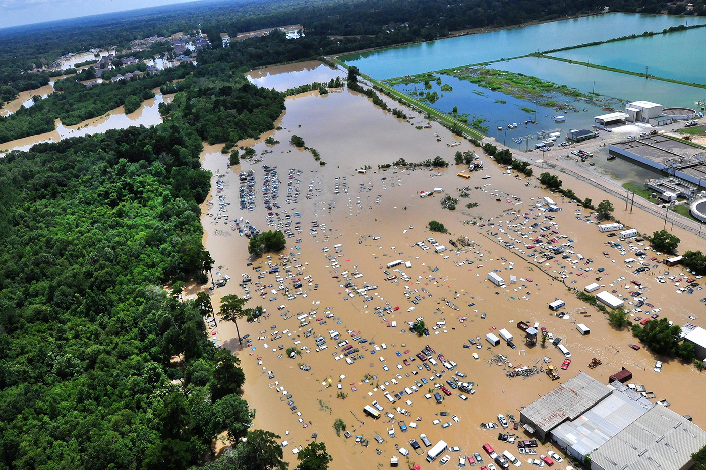
Crazy Weather - Public DomainAll over the planet, global weather patterns have gone completely nuts.  Just over the past few days we have seen “life threatening” heatwaves, extremely dangerous wildfires, vicious tornadoes and unprecedented flooding – and that is just in the United States.  And of course this is just the continuation of a trend that stretches back to last year, when extremely weird weather created “apocalyptic-like conditions” in many areas around the world.  So why is this happening?  For decades, we could count on weather patterns falling within fairly predictable parameters, but now that is completely changing all of a sudden.  All over the globe we are seeing things happen that we have never seen happen before, and the weather just seems to get even more crazy with each passing month.

Just consider what has been going on the past few days.  Let’s start with the “life threatening” heatwave that is currently hammering the west coast

The West Coast is in the grip of a ‘life threatening’ triple-digit heatwave that is set to continue well into next week, raising the risk of wildfires.

The National Weather Service has issued excessive heat warnings for southeastern California, southern Nevada, western and southern Arizona, western Oregon and far southwest Washington.

From Oregon to Nevada temperatures are set to top 100F tomorrow and into Monday, with Phoenix, Arizona, predicted to top out at 116F.

These are temperatures that you might expect to see in July or August, but right now summer has not even officially begun yet.

And as the article quoted above noted, these extremely high temperatures bring with them a much higher risk of wildfires.  In fact, firefighters in southern California are currently fighting a horrible fire that is raging wildly out of control and that has already forced thousands of people (including Kim Kardashian and Kanye West) out of their homes

…click on the above link to read the rest of the article…

Despite UK Flooding, A Yorkshire Town Remains Dry

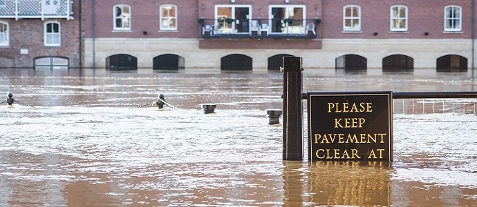
DESPITE UK FLOODING, A YORKSHIRE TOWN REMAINS DRYyork flood pavement

Despite widespread flooding in North of Britain last week, Pickering, Yorkshires main flooding region, beat the weather and stayed dry. Notwithstanding, the town had been refused financial aid for a defense mechanism, so it tackled it with wringing success.

The town prevented the recurrent inundation by using what many will call an “old-fashioned”method.

On their own, the citizens worked with nature to control the floods.

The towns triumph should influence the decisions that were made by policy makers after last month’s floods which saw at least £5 billion channeled to flood control schemes elsewhere.

Success of the town is a mock to the people who believe that flood cannot be prevented in an environmental friendly manner. The people who subscribe to this school of thought fail to understand why the government fails to take into account all safety measures, and insist on dredging waterways, in order to order to protect fauna and flora.

Dredging is largely unsafe, pointless and environmentally unsafe. This is because scooping of silt and weed from the river bed causes water to flow faster increasing the danger of downstream flooding.

Pickering is situated at the bottom of a steep gorge draining of the North York moors, the residents of the town have been victims of perennial flooding. There have been 4 floods recorded since 1999-2007 causing damage of about £7 million. The solution mooted to the residents was to build a £20 million wall to keep water out of the river. This solution was however disadvantageous as it would reduce the attractiveness of the area hence reduce tourism. It was also found to be uneconomically viable as the costs would outweigh the benefits accrued; too few people would be protected by the wall.

…click on the above link to read the rest of the article…

The Looming Environmental Disaster In Missouri That Nobody Is Talking About

The Looming Environmental Disaster In Missouri That Nobody Is Talking About

Since we first highlighted the potential for a “catastrophic event” in Missouri three months ago, there has been little mainstream media coverage. However, as Claire Bernish via TheAntiMedia.org notes, residents near the smoldering fill have expressed increasing frustration with the quarreling agencies offering few answers for an increasing number of health issues, like asthma. For now, it’s startlingly apparent no one knows exactly what’s happening with the West Lake and Bridgeton Landfills – though the smoldering below the surface doesn’t cease and floodwaters continue to rise.

What happens when radioactive byproduct from the Manhattan Project comes into contact with an “underground fire” at a landfill? Surprisingly, no one actually knows for sure; but residents of Bridgeton, Missouri, near the West Lake and Bridgeton Landfills — just northwest of the St. Louis International Airport — may find out sooner than they’d like.

And that conundrum isn’t the only issue for the area. Contradicting reports from both the government and the landfill’s responsible parties, radioactive contamination is actively leaching into the surrounding populated area from the West Lake site — and likely has been for the past 42 years.

In order to grasp this startling confluence of circumstances, it’s important to understand the history of these sites. Pertinent information either hasn’t been forthcoming or is muddied by disputes among the various government agencies and companies that should be held accountable for keeping area residents safe.

*  *  *

West Lake Landfill was placed on the National Priorities List in 1990, giving the Environmental Protection Agency regulatory authority through its designation as a Superfund site. However, the area wasn’t a planned radioactive waste storage site. Uranium processing residue leftover from the World War II-era Manhattan Project was originally dumped there, illegally, by a contractor for former uranium processing company and General Atomics affiliate, Cotter Corporation in 1973.

…click on the above link to read the rest of the article…

Stunning Drone Footage Of The Midwest Flooding Wreaking Havoc On US Oil

Stunning Drone Footage Of The Midwest Flooding Wreaking Havoc On US Oil

After the first deadly winter storm this season, now come the floods: the near-record water level across the U.S. Midwest has disrupted everything from oil to agriculture, forcing pipelines, terminals and grain elevators to close. This is the worst flood in the region since May 2011, when rising water on the Mississippi and its tributaries deluged cities, slowed barge traffic and threatened refinery and chemical operations and is just shy of the worst flood of breaking 30-year records.

According to Bloomberg, the floods have killed at least 20 people and shut hundreds of roads across Missouri and Illinois, according to AccuWeather Inc. Rain-swollen rivers will set records in the Mississippi River basin through much of January. Fifty miles (80 kilometers) of the Illinois River remain closed, according to the U.S. Coast Guard, as well as five miles of the Mississippi River.

Additionally, the Coast Guard issued a high-water safety advisory for 566 miles of Mississippi River between Caruthersville, Missouri, and Natchez, Mississippi. It also instituted high-water towing limitations near Morgan City, Louisiana, for vessels heading south that are 600 feet or shorter, it said in a statement.

And while water levels have started to recede in some areas, closures and restrictions remain in place for safety, said Jonathan Lally, a spokesman for the U.S. Coast Guard. “The high water is kind of moving in a big glob and it’s on its way down,” he said Friday in a telephone interview from New Orleans.

The impact of the flood has hit farmers, with hog producers in southern Illinois calling other farmers, hoping to find extra barn space to relocate pigs. Processors are sending additional trucks to retrieve market-ready pigs, she said. In one case, an overflowing creek took out electricity and made roads impassable, causing 2,000 pigs to drown.

But the flood’s most adverse economic impact may be on oil,  which may see an even greater increase in stockpiles as a result, pushing the price of oil even lower.

…click on the above link to read the rest of the article…
 

Freak storm rips though Sydney with tornadoes, flooding, hail, 200kph winds (PHOTO, VIDEO)

Freak storm rips though Sydney with tornadoes, flooding, hail, 200kph winds (PHOTO, VIDEO)

© Kang Seblak
A destructive storm has hit Sydney, Australia, bringing tornadoes, flooding, golf-sized hail stones, and up to 213 kilometer per hour winds, which caused serious damage, triggered evacuations, and trapped people indoors.

A Sydney suburb was labeled a disaster zone after a tornado ripped through its southern beaches with golf-sized hail stones and rattling winds that caused tremendous damage to the neighborhood.

…click on the above link to read the rest of the article…

Why Is This Happening? Unprecedented Flooding Has Hit The U.S. Within The Last 30 Days

Why Is This Happening? Unprecedented Flooding Has Hit The U.S. Within The Last 30 Days

South Carolina Flood 2015Over the past 30 days, major floods have hit the east coast, the west coast and now the middle part of the country.  So why is this happening?  Why is the U.S. being hit by so many catastrophic weather events all of a sudden?  During the past month flooding has caused billions of dollars in damage, and in many areas the clean up is going to take well into next year.  Some pundits are blaming El Nino, but others are pointing to other potential reasons for why this may be happening.  Let’s start by taking a look at some of the biggest flood events that have happened over the past 30 days…

Hurricane Joaquin never made landfall on the east coast, but moisture from the storm had a tremendous impact – particularly in South Carolina.  In fact, the governor of the state said that the region had not seen that type of rain “in a thousand years”

“We haven’t had this level of rain in the low-country in a thousand years — that’s how big this is,” said South Carolina Gov. Nikki Haley. Days of record rainfall and catastrophic flooding left at least seventeen people dead in South Carolina and two dead in North Carolina, Oct. 6, 2015. Thirteen dams have failed.

It would be very difficult to overstate the amount of damage that was caused by this storm.  Some officials are estimating that the total amount of economic damage done “will probably be in the billions of dollars”

The rains may have stopped in South Carolina, but the danger and the work to rebuild are far from over.

“I believe that things will get worse before they get better,” Columbia Mayor Steve Benjamin told reporters Monday.

…click on the above link to read the rest of the article…

World’s Oceans Could Rise Higher, Sooner, Faster Than Most Thought Possible

World’s Oceans Could Rise Higher, Sooner, Faster Than Most Thought Possible

New research shows that consensus estimates of sea level increases may be underestimating threat; new predictions would see major coastal cities left uninhabitable by next century

‘Roughly 10 feet of sea level rise—well beyond previous estimates—would render coastal cities such as New York, London, and Shanghai uninhabitable.’ (Image: Woodbine)

If a new scientific paper is proven accurate, the international target of limiting global temperatures to a 2°C rise this century will not be nearly enough to prevent catastrophic melting of ice sheets that would raise sea levels much higher and much faster than previously thought possible.


“Parts of [our coastal cities] would still be sticking above the water, but you couldn’t live there.”
—Dr. James Hansen


According to the new study—which has not yet been peer-reviewed, but was written by former NASA scientist James Hansen and 16 other prominent climate researchers—current predictions about the catastrophic impacts of global warming, the melting of vast ice sheets, and sea level rise do not take into account the feedback loop implications of what will occur if large sections of Greenland and the Antarctic are consumed by the world’s oceans.

A summarized draft of the full report was released to journalists on Monday, with the shocking warning that such glacial melting will “likely” occur this century and could cause as much as a ten foot sea-level rise in as little as fifty years. Such a prediction is much more severe than current estimates contained in reports issued by the Intergovernmental Panel on Climate Change (IPCC)—the UN-sponsored body that represents the official global consensus of the scientific community.

“If the ocean continues to accumulate heat and increase melting of marine-terminating ice shelves of Antarctica and Greenland, a point will be reached at which it is impossible to avoid large scale ice sheet disintegration with sea level rise of at least several meters,” the paper states.

…click on the above link to read the rest of the article…

Calgary thunderstorm causes power outages, flooding in Chestermere

Calgary thunderstorm causes power outages, flooding in Chestermere

Lightning advisory that grounded all flights at Calgary airport now lifted

People in Calgary woke up with a bang early Sunday morning as a line of thunderstorms hovered over the city, bringing lightning, power outages and overland flooding in communities to the east.

As the storms moved eastward, severe thunderstorm warnings issued by Environment Canada remained in effect for Red Deer, Ponoka, Innisfail and Stettler by 3 p.m. MT. An earlier storm warning for Calgary was cancelled at 9:40 a.m. MT.

“Meteorologists are tracking a dangerous thunderstorm capable of producing up to penny size hail and flooding rain,” the agency said on its website.

Thunderstrom watches — the agency’s less urgent category of alert — were still in effect for much of the southeastern part of the province by late afternoon.

When the storm hit early Sunday morning it caused flash-flooding in parts of northeast Calgary as well as Langdon and Chestermere east of the city.

The Alberta emergency public alert system tweeted a warning about overland flooding in Chestermere.

“While short, this was an intensely severe storm that brought an amount of water that overwhelmed our systems” Steve Bagley, Chetermere’s director of emergency management. said in a release.

“We are working hard to assist residents and restore services as quickly as possible.”

Officials said power had been restored to most parts of the city by 1:30 p.m. MT and that Chestermere Lake water levels were under control.

Langdon resident Andrew Kucy said it didn’t take long for his basement to flood.


…click on the above link to read the rest of the article…

Unnatural Disaster: How Global Warming Helped Cause India’s Catastrophic Flood

Unnatural Disaster: How Global Warming Helped Cause India’s Catastrophic Flood

The flood that swept through the Indian state of Uttarakhand two years ago killed thousands of people and was one of the worst disasters in the nation’s recent history. Now researchers are saying that melting glaciers and shifting storm tracks played a major role in the catastrophe and should be a warning about how global warming could lead to more damaging floods in the future.

Two years ago this month, a flood devastated the Himalayan village of Kedarnath, India, the destination of half a million Hindu pilgrims annually. The town sits 11,500 feet up in a tight valley. Sharp, snowy peaks tower on three sides and a stone temple sits at one end. The flood — which occurred on June 17, 2013 — was India’s worst disaster in a decade. Several thousand people drowned. The deluge tore apart dozens of bridges, swept away miles of paved roads, and carried off herds of livestock. 

Government officials, scientific researchers, and media commentators soon speculated about the cause of the flood and about why so many people had died. They pointed to the early and heavy monsoon rains. They railed against poorly built homes, unregulated development along the Mandakini River that runs through Kedarnath, and soil erosion caused by thousands of pilgrims trekking on foot and on donkeys to reach this remote town in the northern Indian state of Uttarakhand.

All these factors contributed. Yet in the two years since the flood, scientists studying with the care and intensity of forensic investigators have added another key cause: global warming. In recent papers, they conclude that melting glaciers and shifting storm tracks may soon set off more catastrophic floods in mountainous regions of India and adjacent countries. Atmospheric scientists say that in northern India the intense rains that preceded the disaster are extremely rare. 

…click on the above link to read the rest of the article…


Malawi faces ‘unprecedented’ flood disaster – Africa – Al Jazeera English

Malawi faces ‘unprecedented’ flood disaster – Africa – Al Jazeera English.

The waters may be receding and the rainfall subsiding but Malawi is only now coming to terms with the “unprecendented” floods that hit the southern half of the country last week.

At least 176 people lost their lives and another 200,000 have been displaced when heavy rains submerged homes, schools, and in places, washing away an entire village.

The Malawi Defence Force has reportedly rescued at least 4,000 people, but there are fears that many more still need help. At least 153 people are unaccounted for.

“It has shocked all of us: from government, to donors to the people,” Robert Kisyula, national director of international NGO World Vision Malawi, told Al Jazeera on Saturday. “People hung on to trees,waiting for the waters to subside, as they usualy do, but water kept on coming and they were washed away.

“These were unprecedented floods, don’t let anyone you otherwise,” he said.

…click on the above link to read the rest of the article…

Olduvai IV: Courage
Click on image to read excerpts

Olduvai II: Exodus
Click on image to purchase

Click on image to purchase @ FriesenPress