“Extremely Dangerous” – Hurricane Ida Almost Category 5 Strength As It Nears Louisiana
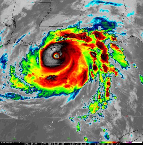
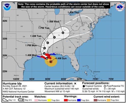
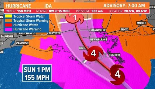
Hurricane Ida has rapidly strengthened into a major hurricane with maximum sustained winds of 150 MPH, just seven mph shy of a Category 5. The storm is set to strike Louisiana later this afternoon/evening, and on the same day, 16 years ago, Hurricane Katrina struck the area.
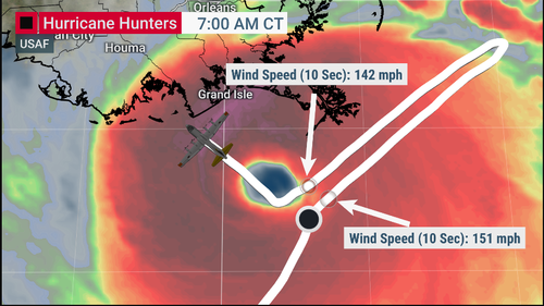
As of 0600 ET, National Oceanic and Atmospheric Administration (NOAA) plane flew into the storm and found Ida is an “extremely dangerous Category 4 hurricane about to make landfall in southeastern Louisiana later today.”
Reports from an NOAA Hurricane Hunter aircraft indicate that maximum sustained winds have increased to near 150 mph (240 km/h) with higher gusts. The latest minimum central pressure estimated from reconnaissance aircraft data is 935 mb (27.61 in).
An elevated NOAA C-MAN station at Pilot’s Station East near Southwest Pass, Louisiana, recently reported a sustained wind of 82 mph (131 km/h) and a gust to 107 mph (172 km/h). Another NOAA elevated C-MAN station at Southwest Pass recently reported a sustained wind of 77 mph (124 km/h) and a wind gust of 93 mph (150 km/h).
Ida is currently over the Gulf of Mexico where it could strengthen even more before making landfall around 1800 ET.
A Hurricane Warning has been posted for Intracoastal City, Louisiana, to Pearl River, Mississippi.
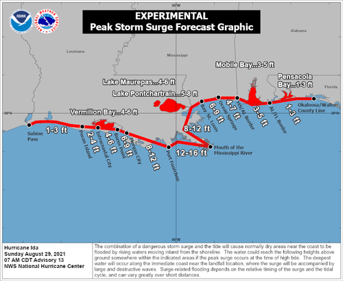
Storm surges could be significant across Louisiana and Mississippi. For instance, a 10-foot to 15-foot storm surge is forecasted from Morgan City, Louisiana, to Ocean Springs, Mississippi. A storm surge of 5-8 feet is possible for Lake Pontchartrain.
…click on the above link to read the rest of the article…
