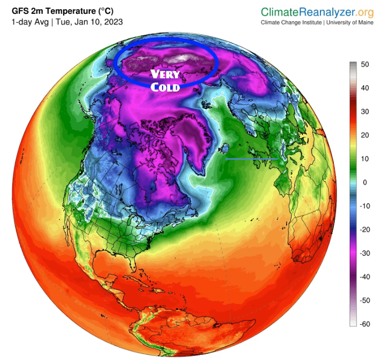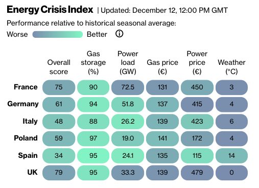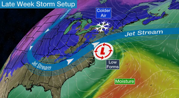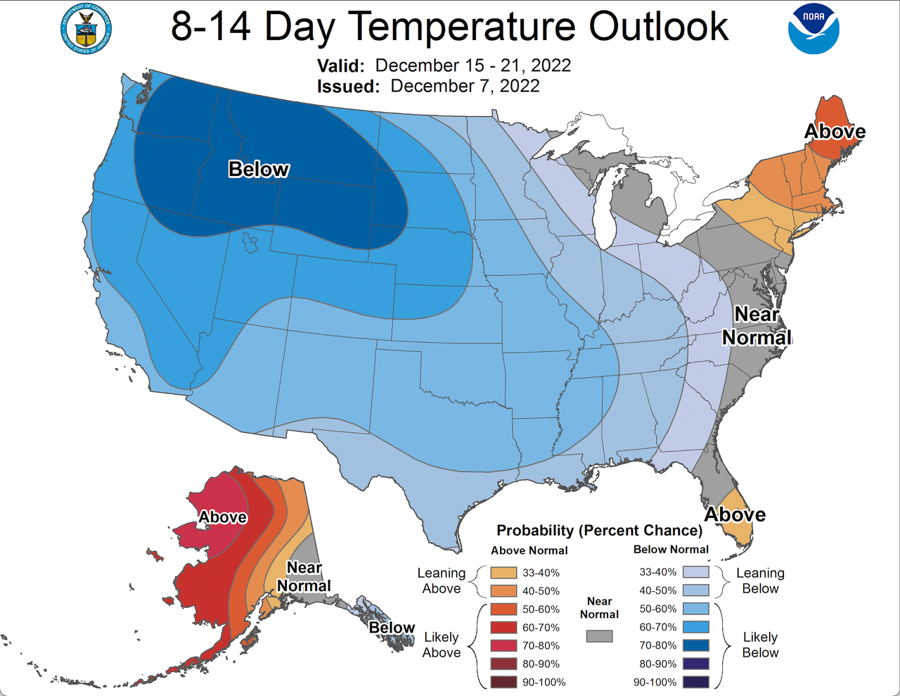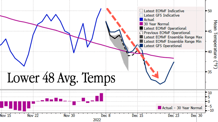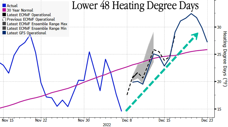
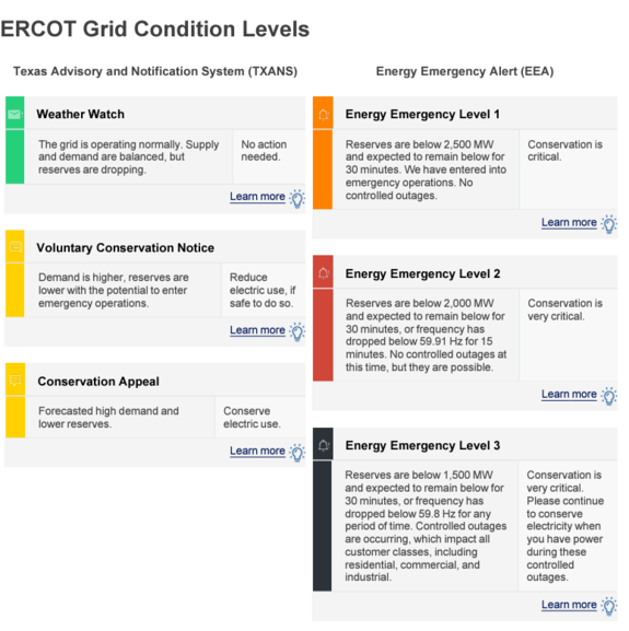


Central Texas has been frozen since earlier this week after an Arctic front rolled into the Southern U.S. Parts of central, west, and north Texas and nearby states Arkansas and Tennessee were under ice storm warnings, per the National Weather Service Prediction Center. The freezing temperatures and sleet should end by this weekend.
“The prolonged and damaging ice storm that has impacted a large region from Texas to Tennessee is forecast to finally come to an end today as a final surge of moisture slides eastward,” the NWS said. “Highs will return into the 40s and 50s by Friday, likely eliminating any icy concerns.”
“FINALLY beginning to see some clearing on radar. Road conditions will slowly improve as we climb into the mid 30s today. Slick spots will persist overnight but widespread improvement is expected tomorrow. Allow for extra travel time today. It’s still slushy!” the Fort Worth National Weather Service account tweeted Thursday.
More than 405,000 customers out of 13 million are without power, according to Poweroutage.us.
Several days of icy conditions had canceled over 2,000 flights across several states as of Wednesday afternoon, the Wall Street Journal reported. Driving was dangerous throughout Texas this week. The storm has been blamed for 10 traffic accident deaths across three states, the Associated Press reported. The sleet and freezing rain also created ice layers on trees, causing the branches to snap off.