Home » Posts tagged 'earthquakes'

Tag Archives: earthquakes

Olduvai
Click on image to purchase

Olduvai III: Catacylsm
Click on image to purchase

Post categories

Post Archives by Category

Dutch Plan To Boost Gas Output At Earthquake-Prone Site Sparks Anger

Dutch Plan To Boost Gas Output At Earthquake-Prone Site Sparks Anger

Residents in the Groningen area in the Netherlands have voiced their anger at a plan by the Dutch government to potentially double this year production from the Groningen gas field, which has been hit by earthquakes in the past.

The Dutch government said on Thursday that it might need more gas to be pumped at Groningen, once Europe’s biggest gas field, which the Netherlands has pledged to phase out this decade after frequent earthquakes in the past damaged homes in the area.

After years of debates and measures to curb production at the field, the Dutch government decided in 2018 that output at Groningen would be terminated by 2030, with a reduction by two-thirds until 2021-2022 and another cut after that. The authorities had already limited production from the field because of the earthquakes, but they decided in 2018 that the risks and costs were no longer acceptable.

Now the government says that more gas needs to be extracted from the Groningen gas field in 2022 to ensure supply because of long-term export contracts with Germany and a delay in the commissioning of a facility in the Netherlands to treat imported gas for use for Dutch households.

The government is expected to make a final decision by April 1 on how much gas will be extracted from Groningen this year.

“I realize it really is a disappointment for people in the quake region that it has indeed proved necessary to extract more gas,” Dutch Economic Affairs Minister Stef Blok said on Friday, as carried by Associated Press.

The Groningen Earth Movement, a group of residents who have suffered damages from earthquakes, slammed the plan for more gas extraction at the field.

The Ministry of economic affairs and climate policy is playing with the safety of people in Groningen, the movement said, adding that “a government should not and cannot treat the safety of its citizens so lightly.”

Does Climate Change Increase Earthquakes and Volcanic Activity?

Does Climate Change Increase Earthquakes and Volcanic Activity?

From top; Columbia Glacier, Mount Blackburn, Worthington Glacier, Matanuska Glacier

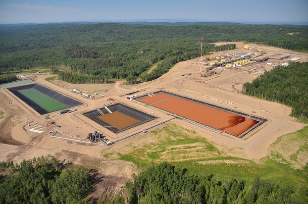
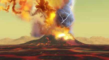
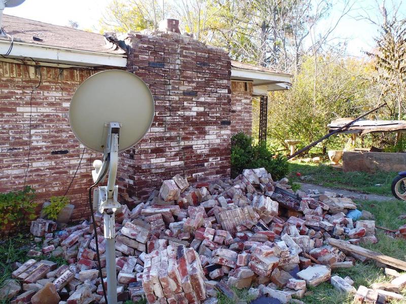
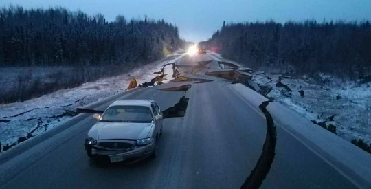
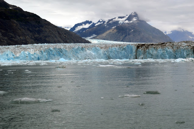
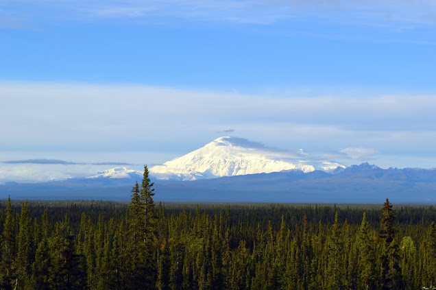
Something many people aren’t aware of is just how climate change is affecting natural disasters once thought to have no connection to weather and/or climate – earthquakes and volcanic activity. Unfortunately, these two phenomena are predicted to also get much worse over time due to isostatic rebound caused by the melting of the ice sheets and glaciers. A new study demonstrates this rather well; but an even gloomier study also explains how this issue can also affect the release of methane hydrates. Methane hydrates are a mixture of methane and ice held in place by temperature and pressure. They are also known by various other names, quote:

“Several other names are commonly used for methane hydrate. These include: methane clathrate, hydromethane, methane ice, fire ice, natural gas hydrate, and gas hydrate. Most methane hydrate deposits also contain small amounts of other hydrocarbon hydrates. These include propane hydrate and ethane hydrate.

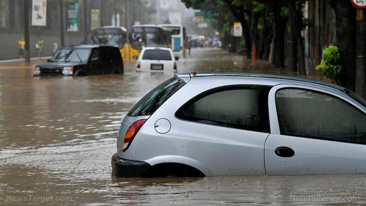
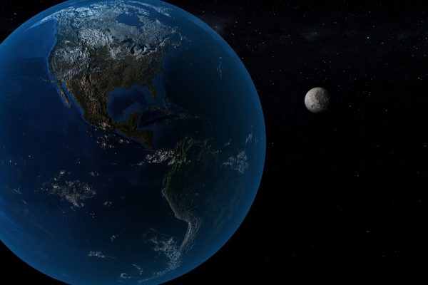
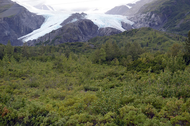
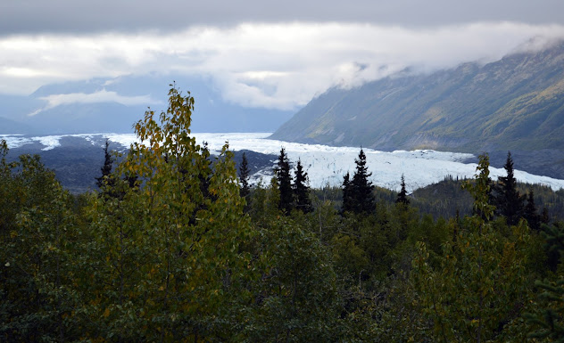
So, these predicaments by themselves interact with several other predicaments and are threat multipliers. Another study points out how melting glaciers contribute to earthquakes. As most people well know, melting glaciers and thawing permafrost also cause sea level rise, increased carbon emissions, landscape slumps, thermokarst lakes and depressions, and many other issues covered in the file on the cryosphere. Sheesh, just these two paragraphs in and of themselves are a feast for research into positive feedback loops!

Another study shows how isostatic rebound can also affect ice sheets grounded in the ocean. So, adding volcanoes and earthquakes to the list of effects climate change exacerbates and knowing that climate change is caused by ecological overshoot, this means that there are even far more disasters we have to look forward to in the future than previously thought.

…click on the above link to read the rest of the article…


Change BC Fracking or Expect Damaging Earthquakes: Report

Change BC Fracking or Expect Damaging Earthquakes: Report

The new warning comes from a former senior scientist with the province’s oil and gas commission.

Since 2005, British Columbia’s experiment with hydraulic fracturing of gas wells has changed the geology of the province’s northeast. It is now home to some of the world’s largest fracking-induced earthquakes outside of China.

In 2018, one magnitude 4.6 tremor tied to fracking even rattled buildings in Fort St. John and stopped construction on the Site C dam. It was followed by two strong aftershocks.

Now, a comprehensive new scientific study warns that stress changes caused by the technology could trigger a magnitude 5 earthquake or greater in the region, resulting in significant damage to dams, bridges, pipelines and cities if major regulatory and policy reforms aren’t made soon.

Allan Chapman, the author of the paper served as a senior geoscientist for B.C.’s Oil and Gas Commission and as its first hydrologist from 2010 to 2017. Prior to working for the commission, he directed the Ministry of Environment’s River Forecast Centre, which forecast floods and droughts.

Chapman, now an independent geoscientist, said that he felt compelled to write the paper because researchers have concluded that fracking “induced earthquakes don’t have an upper limit” in terms of magnitude.

In addition, “there is a clear and present public safety and infrastructure risk that remains unaddressed by the regulator and the B.C. government.”

B.C.’s Oil and Gas Commission rejected Chapman’s conclusions in a statement to The Tyee, saying his study contained “speculation.”

Recent events in China’s Sichuan province prove that fracking can trigger large and destructive earthquakes.

…click on the above link to read the rest of the article…

Thousands of Quakes, Tied to Fracking, Keep Shaking the Site C Dam Region

Thousands of Quakes, Tied to Fracking, Keep Shaking the Site C Dam Region

Several recent reports on the tremors add to concerns about the mega-project’s stability.

Building the Site C dam in northeastern British Columbia is proving more difficult than officials predicted due to unstable ground on the northern bank. Adding to concerns: myriad earthquakes.

For nearly a decade, The Tyee has reported on a rising number of earthquakes caused by the hydraulic fracturing of shale formations in the region. Now, new studies put the number of such tremors in recent years in the many thousands, raising more worries about the future of the mega-project.

Researchers warn the shaking could become strong enough to crumble critical infrastructure such as roads, high-rise buildings — and dams.

B.C.’s regulatory practices try to limit fracking after small earthquakes have been triggered. But that’s “not sufficient to protect critical or vulnerable infrastructure that have unacceptable failure consequences,” noted seismic hazard expert Gail Atkinson in the May 7 issue of Nature Reviews.

No one can yet predict frack-triggered quakes before they happen, and “hazard forecasting” remains a “critical area of research.”

Another study, released this week by researcher Ben Parfitt at the Canadian Centre for Policy Alternatives, took data from federal earthquake catalogues to show how many tremors the fracking industry is producing near the Site C dam.

The numbers are staggering. Between 2017 and 2018 alone, the industry triggered 6,551 earthquakes greater than 0.8 magnitude in the region near the troubled mega-project with a price estimate of $12 billion and rising.

Drilling by Canadian Natural Resources Ltd., for example, triggered a magnitude 4.6 earthquake in November 2018 that forced the evacuation of the Site C Dam site. It was followed by magnitude 3.5 and 4 events after the fracking ceased.

…click on the above link to read the rest of the article…

The Quake Threat to Dams Posed by Fracking Was Long Warned

The Quake Threat to Dams Posed by Fracking Was Long Warned

A new trove of internal exchanges shaken loose by Ben Parfitt amplifies decades of safety urgings.

F3CBA861-9E63-4AF0-8300-138E5879B955.jpeg
A ‘shake map’ shows a magnitude 4.5 earthquake that hit northern BC late in 2018, likely caused by fluid injection. The map was created by Gail Atkinson, an expert who called for ‘no frack zones’ around dams. Illustration created by Gail Atkinson. Additional labels by The Tyee.

“Why is this so difficult?” a BC Hydro dam safety engineer plaintively asked his superiors seven years ago.

He’d been stymied again in proposing that because the risks of earthquakes caused by fracking were clear, preventing disaster required creating “no frack” zones around dams.

His sense of urgency runs through a long thread of discussions within BC Hydro and the Oil and Gas Commission surfaced by investigative researcher Ben Parfitt.

For years now the two crown agencies have been reluctant to publicly talk about the risks earthquakes triggered by the oil and gas industry pose to critical dam infrastructure throughout northeastern B.C.

But a freedom of information request by Parfitt at the Canadian Centre for Policy Alternatives has shed new light on what has been a long and often acrimonious internal debate.

Hundreds of emails, letters, memos and meeting notes released by the utility in response to Parfitt’s request and his just published investigationmake the following important revelations:

Officials at BC Hydro have been concerned about the shale gas industry since 2007 when coal bed methane extraction resulted in seismic activity at the Peace Canyon Dam near Hudson Hope. 

The Peace Canyon Dam, which provides six per cent of the province’s electricity, is built on fragile shale rock and wasn’t built to withstand even modest earthquakes.

…click on the above link to read the rest of the article…

Immediate moratorium on fracking in England because of tremor risk

Immediate moratorium on fracking in England because of tremor risk

pnr 190805 Ros Wills 2

Gooseneck at Cuadrilla’s Preston New Road shale gas site, 5 August 2019. Photo: Ros Wills

After seven years of promoting fracking, Conservative ministers have withdrawn their support and blocked the prospects of a shale gas industry.

The UK government has issued an immediate moratorium in England because of the risk of earth tremors. Governments in Scotland, Wales and Northern Ireland have already issued measures that amount to moratoriums on fracking.

In a statement released just after midnight, the Department of Business, Energy and Industrial Strategy (BEIS), said new scientific advice concluded that it was not possible with current technology to predict accurately whether fracking would cause tremors and how big they would be.

Opponents of fracking described the announcement as a victory for communities and the climate but called for a full, permanent ban. IGas, the only industry representative to respond to our invitation to comment, said it was confident it could operate safely and environmentally responsibly. The industry organisation, UKOOG, later said fracking was a long-standing technology and the UK had a world-class shale resource.  Full reaction

Ministers said they had based their decision on a report by the industry regulator, the Oil and Gas Authority (OGA). It had been investigating earth tremors caused by fracking at the UK’s only shale gas site, at Preston New Road, near Blackpool, operated by Cuadrilla.

The report looked at the impacts of fracking the PNR1z well in autumn 2018, which caused more than 50 tremors. The OGA is also examining 134 seismic events caused by fracking the second well, PNR2, in August 2019. They included the UK’s largest fracking-induced tremor, measuring 2.9ML. The British Geological Survey said this tremor was felt by several thousand people, while several hundred reported damage to homes. The OGA suspended fracking within hours.

pnr 190826 uwtoc-2
Campaigners outside Cuadrilla’s shale gas site at Preston New Road near Blackpool, 26 August 2019. Photo: Used with the owner’s consent

 …click on the above link to read the rest of the article…

Alberta Imposes New Fracking Restrictions Near Dam after Quakes

Alberta Imposes New Fracking Restrictions Near Dam after Quakes

Restrictions come as industry-related tremors have rattled nerves and raised concerns.

Fracking well head
Alberta’s Energy Regulator has issued an order restricting fracking activity near a dam located southwest of the densely drilled Drayton Valley following a magnitude 4.3 earthquake in the region last March. Fracking photo by Joshua Doubek, Creative Commons license CC BY-SA 3.0.

The regulator’s new regulations follow a wave of tremors set off by Canada’s oil and gas industry, as well as the release of major scientific papers documenting how fracking and other forms of fluid injection have caused devastating earthquakes.

Such industry-triggered events, some as great as magnitude 5.7, have destroyed homes, caused landslides, and left taxpayers with millions of dollars of damage in Oklahoma, Korea and in China, where citizens have been killed.

Last week, the industry-funded regulator issued an order restricting fracking activity near TransAlta’s Brazeau Dam located 55 kilometres southwest of the densely drilled Drayton Valley following a magnitude 4.3 earthquake in the region last March. 

The exact cause of that earthquake is not known, but the oil and gas industry has previously rocked the region with tremors caused by wastewater injection or by gas extraction, which causes rock to fracture and collapse.The Tyee is supported by readers like you Join us and grow independent media in Canada

The regulator officially banned fracking within five kilometres of the dam site in the deep Duvernay formation, and within three kilometres of the dam site in the shallower formations above the Duvernay.

It also imposed requirements that any fracking operator in the three-to-five-kilometre zone that causes a magnitude 1.0 earthquake must now report the event to the regulator and cease operations totally if it triggers quakes greater than magnitude 2.5.

 …click on the above link to read the rest of the article…

Which SHTF situation is most likely to actually happen?

Which SHTF situation is most likely to actually happen?

Image: Which SHTF situation is most likely to actually happen?

(Natural News) The prepping lifestyle can be overwhelming for most people but at its core, preppers prioritize readiness in all aspects of their lives. But amid all the talk about prepping skills, survival gear, and food supplies, how do you know which disaster event has the highest chance of occurring within your lifetime? (h/t to TheSurvivalistBlog.net)

How to prepare for possible SHTF events

For this article, an “SHTF” event is defined as “any event that upends your life” after it occurs, such as flooding in a major city. These events would be classified as major disasters or catastrophes, not personal emergencies.

On the extreme end of prepping are those who will do whatever it takes to get ready for apocalyptic events like EMP attacks or nuclear world war. However, more realistic preppers are concerned about events that may likely occur in their lifetimes, such as hurricanes or tornadoes.

No matter where you land on the prepping scale of SHTF-readiness, the important thing is to get ready for disasters that happen yearly worldwide.

Take note that the events detailed below are more or less likely to occur depending on your location. According to the U.N.’s Office for Disaster Risk Reduction (UNDRR), the single most likely natural disaster to occur anywhere in the world is flooding.

Flood preparedness

Rising water is “the most likely disaster to befall you anywhere in the developed world,” with about 30 percent of all disasters categorized as flooding. This coincides with data gathered by U.S.-based disaster response agencies and insurers.

Regardless of what causes flooding, it is a deadly and destructive event that occurs yearly. In most cases, a local major body of water will overrun its banks due to several days of heavy rain. However, other factors like dam failure, ice or snow melting, or tsunamis can also create severe flooding. 

 …click on the above link to read the rest of the article…

State Warning: Catastrophic Volcanic Eruptions In California Are ‘Inevitable’

State Warning: Catastrophic Volcanic Eruptions In California Are ‘Inevitable’

The United States Geological Survey (USGS) has warned that California’s next big catastrophe might not be a massive earthquake.  Instead, they say a massive volcanic eruption could plunge the state into a post-apocalyptic hellscape.

In a report released on Monday, the USGS said that at least 10 volcanic eruptionshave taken place in the past 1,000 years and that “future volcanic eruptions are inevitable.” The USGS has previously said that California in dire need of the monitoring of at least 8 active volcanoes.

USGS claims that most people are well aware of the fact that California could experience a major and deadly earthquake, but the general public is less than concerned about a volcanic eruption. “The potential for damaging earthquakes, landslides, floods, tsunamis, and wildfires is widely recognized in California,” the report said according to Newsweek. “The same cannot be said for volcanic eruptions, despite the fact that they occur in the state about as frequently as the largest earthquakes on the San Andreas Fault.”

The USGS estimated the risk of volcanic eruption based on the past 5,000 years of volcanic activity in California. The report further found that there is a 16 percent chance of a small to moderate-sized eruption over the next 30 years. As reported by Newsweek, by comparison, there is a 22 percent chance of a magnitude 6.7 or larger earthquake at the San Andreas Fault in the San Francisco Bay Area in the next 25 years.

Although one cannot stop a volcano from erupting, preparations can be made just in case this inevitable event happens on our watch. The potentially hazardous volcanoes in California are being monitored closely for any changes that indicate an eruption could be on the way, but that may not give those in surrounding communities much time to get awat from the hazard.  Americans by and large have long lost their willingness to prepare for cataclysmic events and natural disasters.

Will BC’s Budding LNG Industry Spark More Quakes and Shake Northeast Housing Prices?

Will BC’s Budding LNG Industry Spark More Quakes and Shake Northeast Housing Prices?

Look at Oklahoma as a possible preview of things to come.

HouseDamageOklahoma.jpg
House damage in central Oklahoma from a magnitude 5.6 earthquake on Nov. 6, 2011. The cause was wastewater disposal in the oil and gas industry. Photo by Brian Sherrod, USGS.

B.C. Premier John Horgan and Prime Minister Justin Trudeau could barely contain their glee last year when LNG Canada declared its $40-billion Kitimat export terminal and related pipeline were going ahead.

But neither leader mentioned the dramatic surge in horizontal drilling and fracking in northeastern B.C. that will be required to extract the natural gas (or methane) needed by LNG Canada. The plant will take methane, process it into liquefied natural gas and then export it overseas.

What Trudeau called the largest capital project in the nation’s history will initially process two billion cubic feet of methane a day — almost half B.C.’s current production. It has the capacity to scale up and gobble four billion cubic feet a day. That’s more than one-third of Canada’s total demand.

According to energy analyst David Hughes, the project will require the drilling of an additional 400 gas wells a year for 40 years, in addition to the almost 500 wells now being drilled annually.

If you want a preview of what that kind of rapid industry expansion brings, look at Oklahoma.

In that state, America’s fifth largest oil producer, earthquakes caused by industry wastewater injection have damaged homes, sparked lawsuits and a regulatory scramble, and even depressed housing prices.

The state and northern B.C. share a well-studied geological phenomenon: unprecedented earthquake activity caused by fluid injection into the ground — mostly wastewater injection in Oklahoma and massive fracking operations in B.C.

 …click on the above link to read the rest of the article…

Magma Under The Yellowstone Supervolcano Is “Rising”, And Scientists Warn That An Eruption Would Devastate The Entire Planet

Magma Under The Yellowstone Supervolcano Is “Rising”, And Scientists Warn That An Eruption Would Devastate The Entire Planet

Could it be possible that a full-blown eruption of the Yellowstone supervolcano is not too far away?  All over the world seismic activity has been increasing in recent years, and this process seems to have accelerated during the early days of 2019.  In particular, quite a few once dormant volcanoes are springing to life again, and this has many concerned about what could potentially happen at Yellowstone.  Of course Yellowstone has never been “dormant”, but there have been new signs of life over the past six months.  Entirely new geysers have sprung out of the ground, Steamboat Geyser has been the most active that it has been in decades, and some geysers have even been shooting “debris and rocks” into the sky.  And now we are being told that “a 465-mile-long piece of molten rock” is “rising” directly under Yellowstone

SCIENTISTS are closely monitoring a 465-mile-long piece of molten rock rising below the Yellowstone caldera, a bombshell documentary has revealed.

The supervolcano, located in Yellowstone National Park, has erupted three times in history – 2.1 million years ago, 1.2 million years ago and 640,000 years ago. Volcanoes typically blow when molten rock, known as magma, rises to the surface following the Earth’s mantle melting due to tectonic plates shifting. However, geologists have revealed how Yellowstone’s magma chamber, which sits on top of the magma plume, is slowly rising each year.

Hopefully nothing major will happen at Yellowstone for a very long time.

But experts assure us that another full-blown eruption will take place one day, and when it does, it could potentially create a global “volcanic winter” which would make growing crops almost impossible and ultimately cause horrific global famines.  The following quote comes from Dr. Christopher Kilburn

…click on the above link to read the rest of the article…

North America Is Rattling: There Have Been 81 Significant Earthquakes In Alaska So Far In 2019

North America Is Rattling: There Have Been 81 Significant Earthquakes In Alaska So Far In 2019

Something is happening to our planet.  The mainstream media is not talking much about this, and the experts assure us that everything is going to be just fine, but the truth is that we have been witnessing an unusual amount of seismic activity all over the world.  Up until just recently, most of the shaking has been elsewhere on the globe, and so it has been easy for most Americans to ignore.  But now North America is rattling, and that isn’t going to be so easy to brush aside.  In fact, 2019 has barely even gotten started and the state of Alaska has already been hit by 81 significant earthquakes:

Alaska notoriously experiences a lot of seismic activity, and in the first nine days of 2019 has been shaken by 81 earthquakes of a magnitude 2.5 or higher according to the United States Geological Survey. Of these, five have been magnitude 4.5 or higher, with one reaching magnitude 6.1. This huge quake took place 54km south-southwest of Tanaga Volcano on January 5.

Is this normal?

No, of course it is not normal.  And the heightened seismic activity that has been taking place all along the Ring of Fire is not normal either.  Just ask the people that were devastated by the massive tsunami that just hit Indonesia.

We live at a time when major Earth changes are taking place, and this has tremendous implications for all of us.  In particular, the hundreds of millions of people that live along the perimeter of the Pacific Ocean need to understand that the Ring of Fire has entered a perilous new phase.  If seismic activity continues to escalate, we could soon be talking about major disasters in which millions of people suddenly die.

Sadly, I am not exaggerating about that one bit.

…click on the above link to read the rest of the article…

BC earthquakes and fracking

BC earthquakes and fracking

As a general rule, the most successful man in life is the man who has the best information

There is no fracking going on right now in northeastern British Columbia, the epicenter of the province’s oil and gas production. Hydraulic fracturing operations have been shut down there for a month due to earthquakes that happened on Nov. 29 about 20 kilometers southeast of Fort St. John.

The BC Oil and Gas Commission (BCOGC), which both regulates and promotes the industry (more on that below), is investigating the 4.5 magnitude quake, followed by two smaller aftershocks. One of the largest oil and gas producers in Canada, Canadian Natural Resources, was fracking in the area.

The commission has linked previous earthquake incidents to increased seismicity, though it states on its website that none of the events in BC have resulted in environmental or property damage. Yet.

For those who have been following our investigations into the BC government’s plans to develop a liquefied natural gas (LNG) industry in BC – something we vehemently disagree with considering its costs will vastly outweigh its benefits – there is an irony in the operations suspension.

A couple of months ago the BC Premier and the Prime Minister gathered with industry representatives to announce the final investment decision by Shell and its Asian partners to go ahead with LNG Canada. The first-in-BC $40 billion LNG compression plant, to be built in Kitimat, will receive natural gas via a new pipeline – filled with the same fracked gas that is causing earthquakes and shutting down the industry while the BCOGC investigates. It would be downright shocking if they found anything that would slow fracking in northeastern BC, which supplies natural gas to BC and Alberta, as well as valuable liquefied gas products like diluted bitumen (dilbit) to the oilsands, not to mention hundreds of millions in royalty payments to the BC and Alberta governments.

…click on the above link to read the rest of the article…

Unstable Planet: Anchorage, Alaska Is Devastated By A Giant 7.0 Earthquake – Is The West Coast Next?

Unstable Planet: Anchorage, Alaska Is Devastated By A Giant 7.0 Earthquake – Is The West Coast Next?

We just got more evidence that our planet is becoming increasingly unstable.  On Friday a magnitude 7.0 earthquake destroyed homes, ripped apart roads and destroyed infrastructure all throughout Anchorage, Alaska.  According to the USGS, the earthquake hit at 8:29 AM and the epicenter was approximately 7 miles north of Anchorage.  That quake was followed by a highly destructive magnitude 5.7 aftershock just a little while later.  Alaska Governor Bill Walker has declared a state of emergency, and the entire region is in a state of chaos.  Unfortunately, as global seismic activity continues to increase, more quakes like this are inevitable.  Like Alaska, the entire west coast of the United States sits directly along the “Ring of Fire”, and many have warned that “the Big One” is coming sooner rather than later.

Tonight, large numbers of Anchorage residents are suddenly homeless, and that includes Alaska’s most famous politician

Light fixtures fell, glass shattered, roadways and supermarket aisles were awash from food spilled from broken jars. Video images showed some roadways had collapsed.  One man tweeted a photo of his toppled chimney and a local television station showed its studio filled with debris.

Former Alaska governor and vice presidential candidate Sarah Palin tweeted, saying her family is intact but her “house is not.”

At this point it is extremely difficult to get around Anchorage.  Numerous roads were shredded by the quake and that includes the only road to Wasilla

The quake was so strong it broke windows, cracked buildings and knocked local news station KTUU off air. Several highway and local roads crumbled in the temblor, stranding cars in the asphalt mess. The shake also broke up the only road connecting Anchorage and the nearby towns of Wasilla and Palmer.

…click on the above link to read the rest of the article…


Pick Your Poison: The Fracking Industry’s Wastewater Injection Well Problem

Pick Your Poison: The Fracking Industry’s Wastewater Injection Well Problem

Oklahoma fracking industry site

The first known oil well in Oklahoma happened by accident. It was 1859 and Lewis Ross was actually drilling for saltwater(brine), not oil. Brine was highly valued at the time for the salt that could be used to preserve meat. As Ross drilled deeper for brine, he hit oil. And people have been drilling for oil in Oklahoma ever since.

Lewis Ross might find today’s drilling landscape in the Sooner State somewhat ironic. The oil and gas industry, which has surging production due to horizontal drilling and fracking, is pumping out huge volumes of oil but even more brine. So much brine, in fact, that the fracking industry needs a way to dispose of the brine, or “produced water,” that comes out of oil and gas wells because it isn’t suitable for curing meats. In addition to salts, these wastewaters can contain naturally occurring radioactive elements and heavy metals.

But the industry’s preferred approaches for disposing of fracking wastewater — pumping it underground in either deep or shallow injection wells for long-term storage — both come with serious risks for nearby communities.

In Oklahoma, drillers primarily use deep injection wells for storing their wastewater from fracked shale wells, and while the state was producing the same amount of oil in 1985 as in 2015, something else has changed. The rise of the fracking industry in the central U.S. has coincided with a rise in earthquake activity.

From 1975 to 2008, Oklahoma averaged from one to three earthquakes of magnitude 3 or greater a year. But by 2014, the state averaged 1.6 of these earthquakes a dayIt now has a website that tracks them in real time.

…click on the above link to read the rest of the article…

Olduvai IV: Courage
Click on image to read excerpts

Olduvai II: Exodus
Click on image to purchase

Click on image to purchase @ FriesenPress